
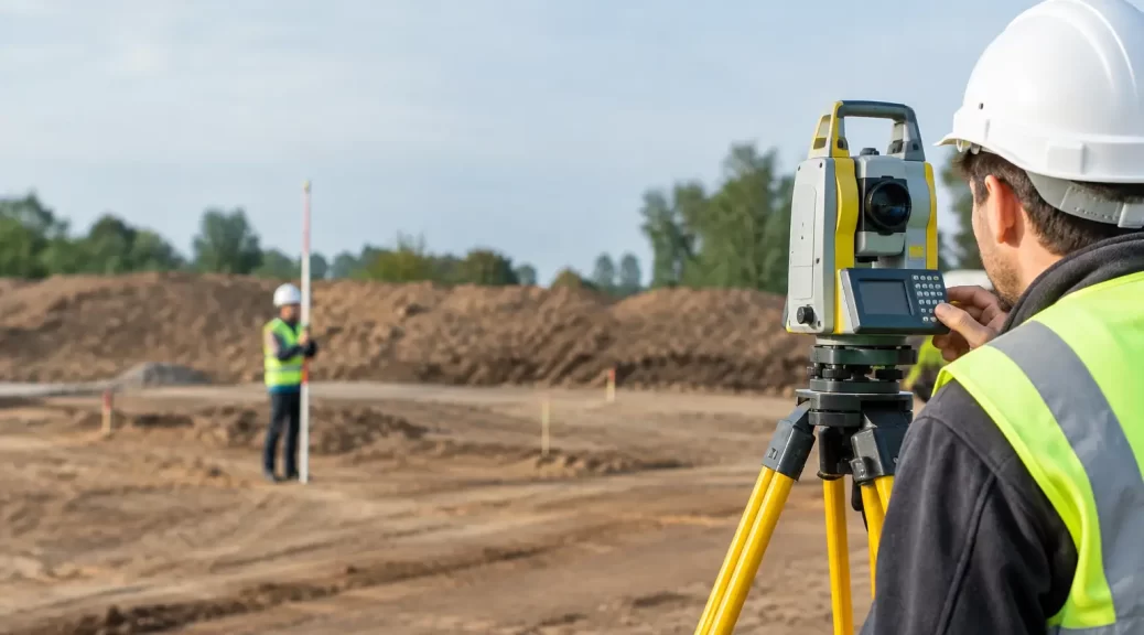
A building can be well designed, fully approved and ready to pour, yet still create a costly problem if the first marks on the ground are wrong. The question, “why do builders need setout surveys?”, comes down to one practical requirement: every part of the construction must be built in the approved position, at the required level, and with sufficient confidence to proceed.
A construction setout survey transfers the approved plans from paper or digital drawings to physical points on site. It gives builders, concreters, excavators and other trades reliable reference marks for excavation, footings, slabs, walls, columns, services and external works. On a tight Melbourne site, a few centimetres can be the difference between an efficient build and an encroachment, redesign or dispute.
Why do builders need setout surveys before construction?
Builders need a setout survey because drawings alone cannot establish where a structure sits in relation to title boundaries, easements, neighbouring buildings, roads or existing site features. A licensed surveyor uses verified survey control, approved plans and specialist equipment to identify the required position on the ground.
This process is particularly important where the building has limited setbacks, irregular boundaries, retaining walls, basement works, party-wall conditions or multiple attached dwellings. It is also critical for commercial, industrial and civic projects where structural grids and service interfaces must align across a larger site.
Setout is not simply a matter of measuring from a fence or guessing from a kerb. Fences can be offset from the legal boundary, kerbs may not be suitable survey references, and site conditions often change after demolition or excavation. A proper survey-based setout provides a controlled starting point for the work.
It protects boundary clearances
The most immediate benefit is confidence that the building footprint is positioned to meet approved setbacks and avoid unintended encroachment. Builders may be working from architectural drawings that show dimensions to boundaries, but the boundary itself must first be correctly identified.
Where a boundary is uncertain, a re-establishment survey may be required before construction setout can begin. This identifies or reinstates the legal title boundaries from available survey evidence. It should not be assumed that old pegs, fences or neighbouring improvements show the correct line.
For a new home, even a small error can affect side setbacks, eaves, fire separation requirements or the ability to install drainage. For a multi-dwelling development, the same error can be repeated across several units, multiplying the cost and time needed to rectify it.
It establishes the correct levels
Position is only one part of a setout survey. Builders also need reliable level information. Finished floor levels, excavation depths, slab levels, driveway grades, drainage connections and retaining wall heights all depend on a consistent vertical datum.
If site levels are not controlled, water may not drain as intended, access grades can become non-compliant, and the finished building may not match planning, engineering or flood-related requirements. Level errors are often harder to correct once concrete is poured or external works are underway.
In areas affected by overland flow, flood controls or complex drainage conditions, early level coordination is especially valuable. The survey information allows the project team to test whether the proposed design works with the site rather than discovering an issue during construction.
What a builder receives from a setout survey
The exact deliverable depends on the project, design documentation and construction sequence. For a standard dwelling, the surveyor may mark building corners and offsets, provide profile boards or reference marks, and supply level information for excavation and slab preparation.
For larger projects, setout can include gridlines, column locations, lift cores, retaining walls, services, roadworks, pavement works and external structures. The surveyor may return at key stages as construction progresses, particularly when original marks have been disturbed by excavation or site activity.
Setout marks need to be practical for the trades using them. A point placed directly where excavation will occur is unlikely to remain available. For that reason, surveyors commonly establish offset marks or profiles outside the work zone, enabling the builder to recover the required line and position during the next stage.
Clear communication matters as much as the marks themselves. The builder should know what each mark represents, the relevant datum, which drawings were used and whether any design issue has been identified. This avoids one trade working from an outdated revision while another relies on the current approved plan.
Setout surveys reduce avoidable rework
Construction programs are tightly linked. Excavation affects footing work, footings affect slabs, slabs affect frames, and every later trade relies on what has already been built. An error made at the first stage can travel through the entire programme.
The direct cost of correcting a misplaced footing or wall is significant. There can also be indirect costs: idle trades, revised engineering, additional approvals, neighbour concerns, programme overruns and strained client relationships. Where an encroachment is involved, the problem may remain attached to the property long after the build is completed.
A setout survey is therefore a relatively small early investment in controlling a much larger construction risk. It does not remove every site issue, and it cannot compensate for incomplete design information. It does, however, provide an independent and accurate basis for starting work.
There is a trade-off in the timing. Setting out too early can mean marks are lost during demolition, bulk earthworks or site clearing. Leaving it too late can delay excavation or concrete work. The most efficient approach is to involve the surveyor early, confirm the design and boundary information, then schedule setout immediately before the relevant work begins.
Setout is not a one-off task on every project
On a straightforward site, initial building setout may be enough to guide the early works. On more complex construction, builders often benefit from staged survey support. This is common for sloping sites, basements, large excavations, constrained urban developments, warehouses and projects with detailed civil or structural requirements.
A staged approach can include an initial feature and levels survey for design, a boundary re-establishment survey where needed, construction setout for excavation and structure, and checking surveys during or after key works. Monitoring may also be appropriate near adjoining buildings, deep excavation or sensitive infrastructure.
This sequence helps designers, builders and owners make decisions using current, consistent information. It also creates a clearer record of what was set out and, where required, what has been constructed.
Verifying critical work during construction
Checking surveys are useful when there is little tolerance for variation. Examples include boundary-adjacent walls, columns, basement structures, drainage pits, retaining walls and finished floor levels. A check before the next irreversible stage can identify a discrepancy while correction remains manageable.
The need for verification depends on the construction method, site constraints and contractual responsibilities. It is not necessary to over-survey a simple project. However, on high-value or high-risk work, relying solely on tape measures and visual alignment is rarely a sound control process.
Coordination with design, planning and approvals
Setout surveys work best when the surveyor receives current documentation before attending site. This usually includes the latest architectural plans, engineering plans, site plan, relevant planning permit conditions and any updated level or drainage requirements.
Changes made during construction should also be communicated. A revised wall location, altered floor level or changed driveway design can affect clearances, services and compliance. Treating the surveyor as part of the project team, rather than calling only when a mark is needed, helps prevent inconsistencies between approval documents and site work.
For Victorian projects, local council requirements, planning conditions and title constraints can all influence what may be built and where. Experienced survey support is valuable because it connects the legal land position with the practical construction outcome. Melbourne Land Surveyors provides this support across the project lifecycle, from early site information through to construction setout and subdivision completion.
A reliable start for the work that follows
Good setout gives a builder something more useful than marks on soil or timber profiles: a dependable reference for managing the job. It allows trades to work from the same coordinates and levels, supports better sequencing, and gives the owner greater confidence that the approved design is being delivered where it should be.
Before machinery arrives or concrete is ordered, confirm that boundaries, plans, levels and setout requirements have been properly considered. That early discipline is one of the simplest ways to keep a construction project moving in the right direction.